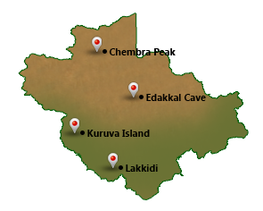
Wayanad District within the north-east of Kerala, India, was shaped on Novemeber
1, 1980 as the twelfth district by carving out areas from Kozhikode and Kannur districts.
Kalpetta is that the district headquarters and the sole municipal city in the district.
The region was referred to as Mayakshetra (Maya's land) within the earliest records.
Mayakshetra evolved into Mayanad and then to Wayanad. The etymology of the word
says it's a mixture of the words Vayal (paddy field) and Naad (land), thus referring
it as 'The Land of Paddy Fields'.
There are several aboriginal tribes in this area. It is set high on the Western
Ghats with altitudes starting from 700 to 2100 m. It is the least populous district
in Kerala.
TOURIST SPOTS IN WAYANAD
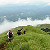
Chembra Peak: :-Chembra Peak being the highest hill in Wayanad, trekking there is a risky and exhilarating mountaineering venture. It is near Meppady town. It almost takes a day to reach the top of the peak.
Read More
Chembra Peak
Chembra Peak being the highest hill in Wayanad, trekking there is a risky and exhilarating
mountaineering venture. It is near Meppady town. It almost takes a day to reach
the top of the peak. Provisions are taken by District Tourism Promotion Council
to issue guides, canvases, sleeping bags, huts and trekking equipments on hire as
the tourists can stay for a day or two in temporary camps at the top of the peak.
From the top of Chembra, the exhilarating view of Wayanad can be enjoyed.
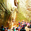
Edakkal Cave: :-Edakkal cave is located 28 kilometers from Kalpetta and is much closer to Ambalavayal. This cave is not a cave in real sense; rather it's a cleft about 96 ft long and 22ft wide in the rock.
Read More
Edakkal Cave
Edakkal cave is located 28 kilometers from Kalpetta and is much closer to Ambalavayal.
This cave is not a cave in real sense; rather it’s a cleft about 96 ft long and
22ft wide in the rock. It is a fissure made by a corner of rock chopped off from
the main body due to some natural causes. The depth of the cleft and the fissure
is 30ft. The fact that in the other section of the large cleft, a huge rock weighing
several tonnes has fallen forming a roof over large part of it, gives it a unique
look of a cave to an ordinary observer. There are some attractive carvings of human
and animal figures, symbols etc which shows of the habitation of highly civilized
people of pre-historic age. This has inspired the historians and archaeologists
to rewrite the history of Wayanad and see them in a different light.
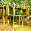
Kuruva Island :-The uninhabited island, lying on the tributaries of east flowing river Kabani and having a cross sectional area of 950 acres of evergreen forest, far away from the disturbances of city life is an ideal picnic spot.
Read More
Kuruva Island
The uninhabited island, lying on the tributaries of east flowing river Kabani and
having a cross sectional area of 950 acres of evergreen forest, far away from the
disturbances of city life is an ideal picnic spot. Rare species of birds, orchids
and herbs are seen here. It is situated 17 kms east of Mananthavady and 40 kms North
West of Sulthan Bathery.
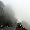
Lakkidi :-Lakkidi does command an eye-catchy and breathe taking setting and it is one of the highest locations in Wayanad. It is about 58 kms north east of Kozhikode and five kms south of Vythiri.
Read More
Lakkidi
Lakkidi does command an eye-catchy and breathe taking setting and it is one of the
highest locations in Wayanad. It is about 58 kms north east of Kozhikode and five
kms south of Vythiri. Lakkidi, the gate way of Wayanad, lies atop Thamarassery,
a ghat pass at an elevation of 700 m above mean sea level. The lofty mountain peaks,
the gurging stream, lush vegetation and the eagle's eye view of the deep valley,
with its winding roads, are awe-inspiring. The 12 kms long journey from Adivaram
to Lakkidi through ghat road with nine hairpin bends amidst thick forests is a fascinating
experience.
.png)


